
My favorite loop hike in the Catskills is a 9 mile hike over Hunter Mountain. If you don’t mind an additional 2 miles of out and back, you can also add the summit of Southwest Hunter (Leavitt Peak) and make the loop hike a total of 11 miles in length.
For the loop as I hike it, the trail begins at the Spruceton Trailhead off of Spruceton Road, climbs Hunter Mountain via the Spruceton Trail, passing the John Robb lean-to along the way, and ending at the Hunter Mountain Fire Tower at the summit. From there, you follow the Hunter Mountain Trail as it descends to the Devil’s Acre Lean-to and the Devil’s Path. Once on the Devil’s Path, you follow that westward, through the notch between Hunter Mountain and Southwest Hunter Mountain, and then descend down to the Diamond Notch Trail and Diamond Notch Falls. Once there, it’s a walk out the Diamond Notch Trail to Spruceton Road, and then a short road walk on Spruceton Road back to the Spruceton Trailhead.
I prefer to do the loop in this direction, as it puts all the climbing up front in the first 3.5 miles, and while the Devil’s Path from the Devil’s Acre Lean-to area is a rocky, rough descent, it would be even tougher as a climb and you’d be climbing for almost 4.5 miles in that direction.
The 3.4 mile ascent on the Spruceton Trail ascends 2,000 feet from the trailhead parking area to the summit of Hunter Mountain. The trail is well maintained, and provides a great walking surface, as it was the original access road used by Fire Tower Observers to staff the Fire Tower when it was operated to watch for forest fires across the Catskills. For the 1st 1.7 miles, the road is wide and well maintained. At the 1.7 mile mark, you reach the notch between Rusk Mountain to the west and Hunter Mountain to the east. From here, the trail/road gets narrower and steeper, but is still maintained well, as it is occasionally used to access the Fire Tower for administrative purposes.
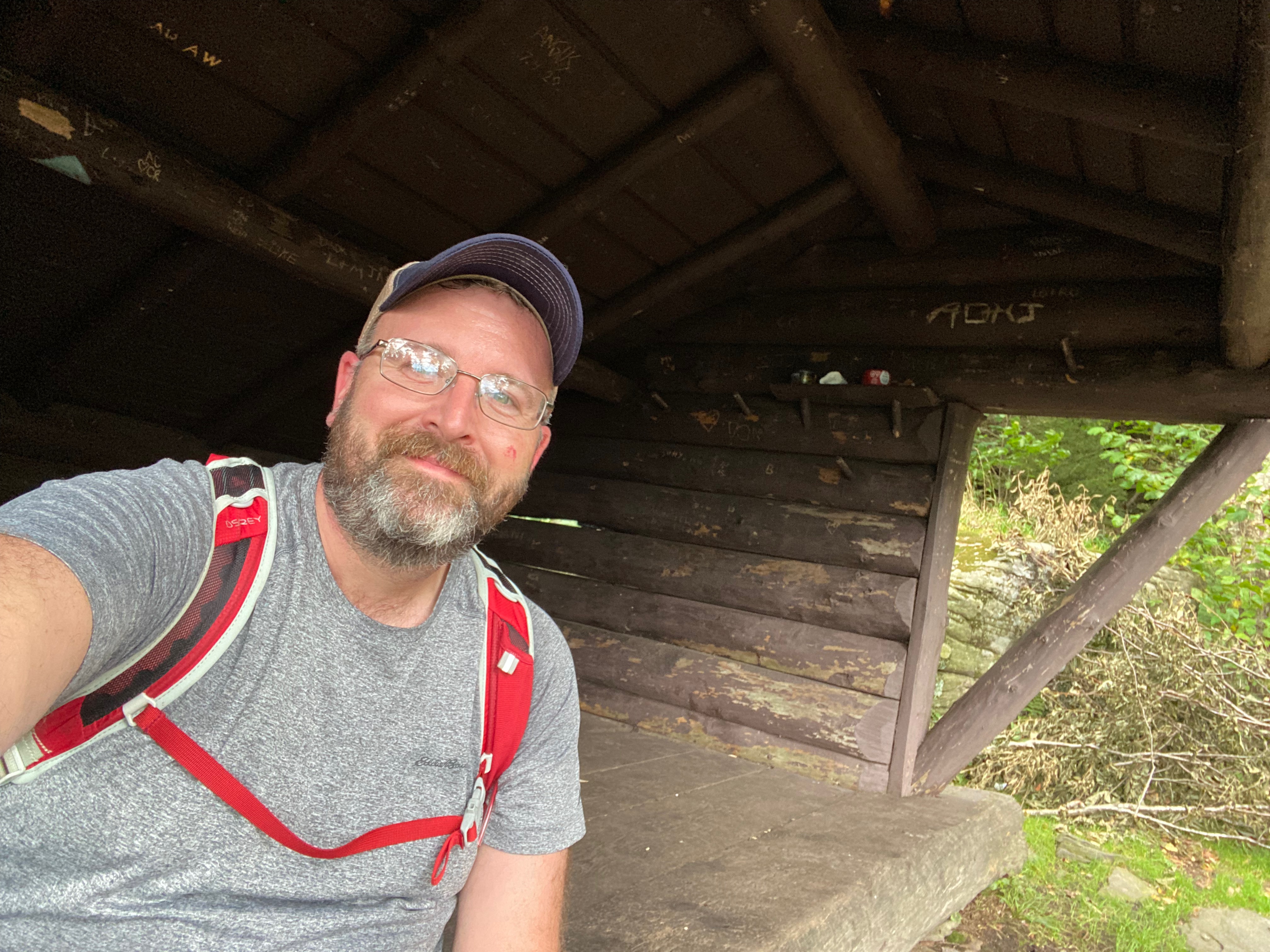
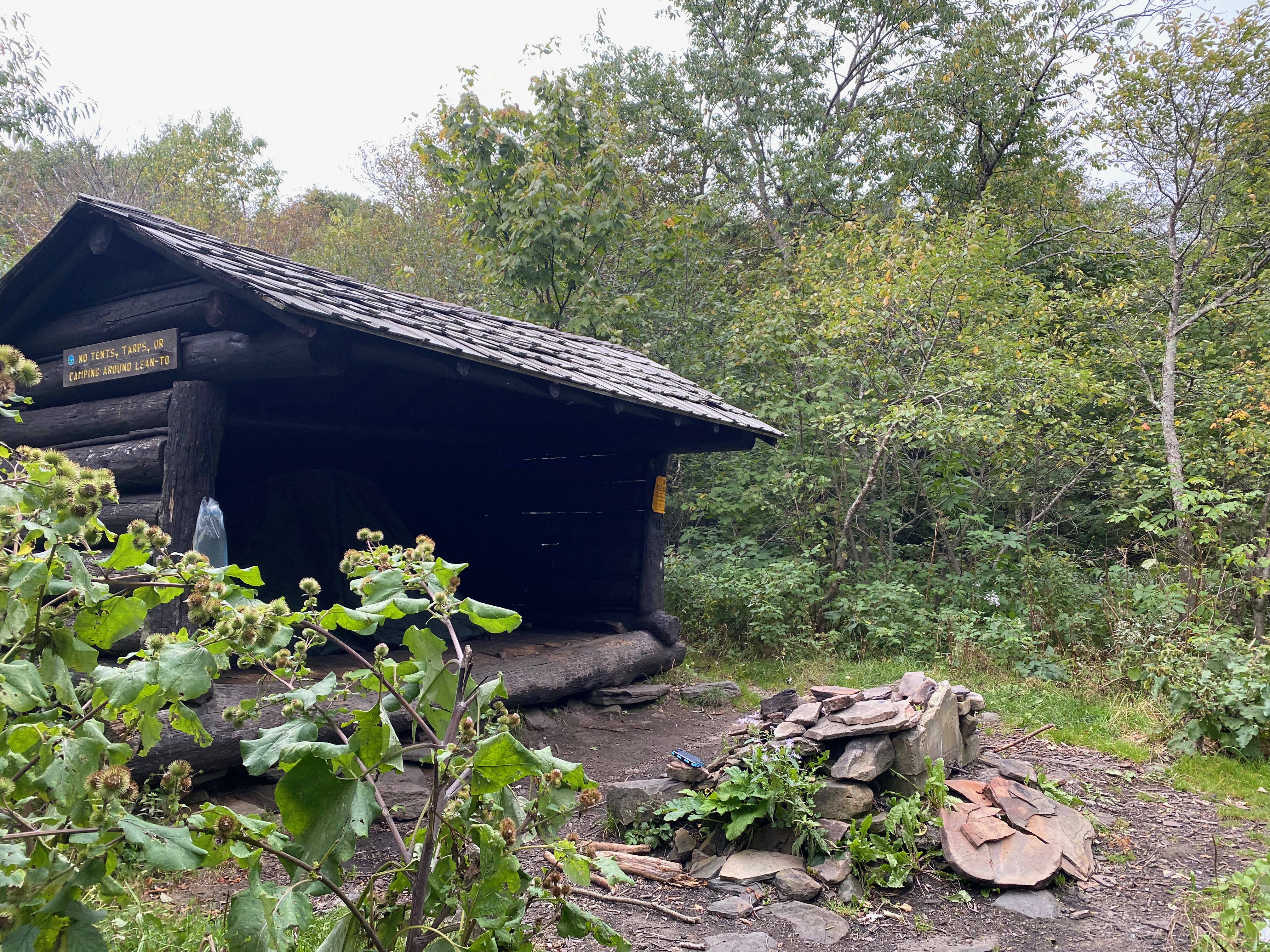
About a half mile above the notch, you come to one of the most reliable springs in the Catskills and shortly thereafter, the side trail to the John Robb Lean-to. This lean-to is perched on a ledge that offers a tremendous view of the Spruceton Valley and even if you aren’t staying at the lean-to, it’s worth the short walk out to see the view. Back on the Spruceton Trail, you pass the intersection with the trail that goes out to the top of the Hunter Mountain Ski Area and then it’s about a mile further to the summit of the mountain.
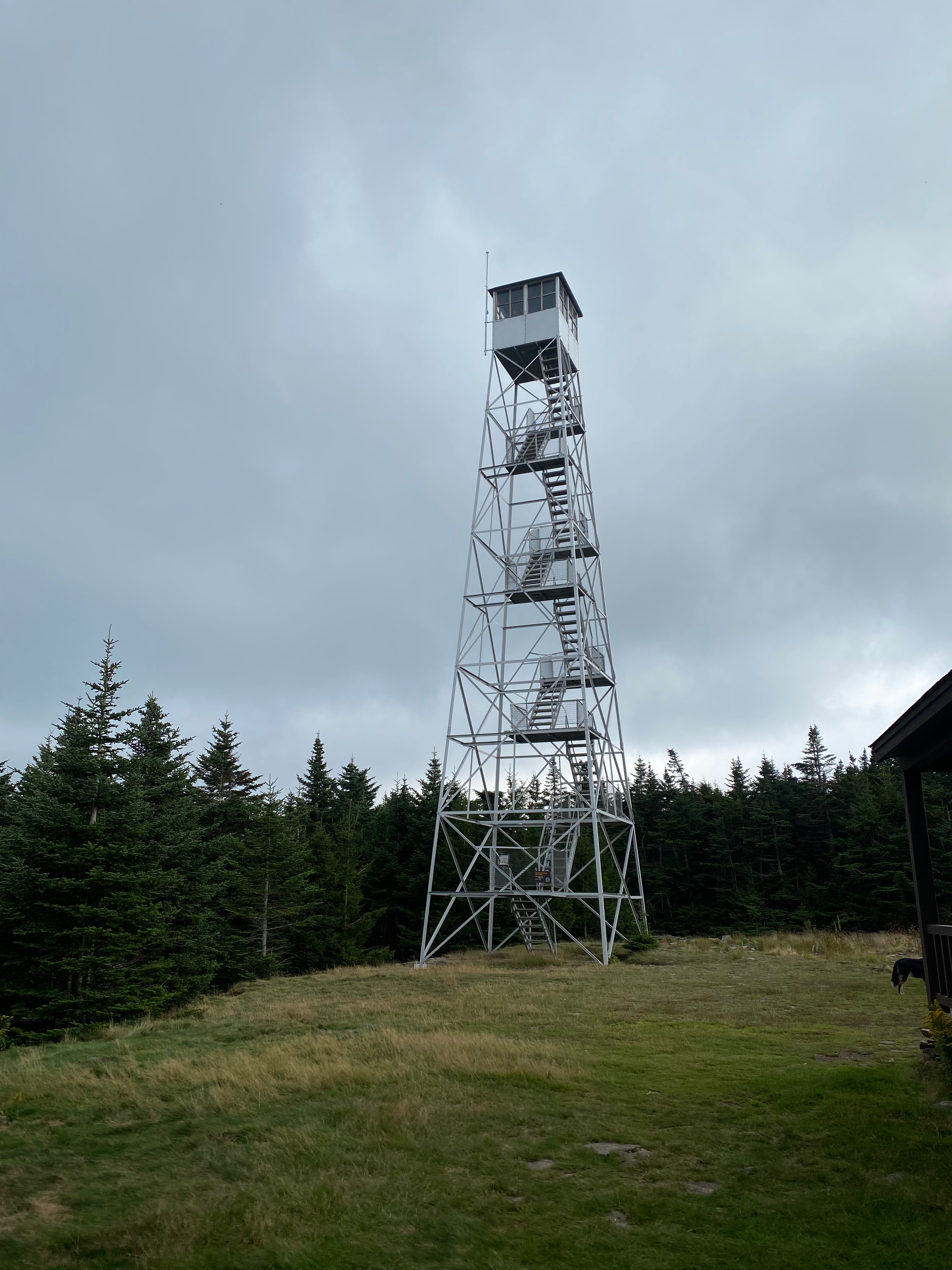
At the summit of the sits the Hunter Mountain Fire Tower, which is the highest (elevation wise) fire tower in New York State. There’s also a small cabin next to the fire tower, that was used by Observers when they weren’t in the towers. These towers were staffed by Observers who would watch the surrounding forests for fires and if smoke was spotted, would call in the location of the fire, so that it could be quickly dealt with. Today airplane and satellite surveillance has replaced the need for fire watching – so the towers are now staffed by volunteers from the Catskill Center (catskillfiretowers.org) on weekends to help welcome visitors and interpret the Catskill Park and surrounding areas.
From the summit, you follow the Hunter Mountain Trail for about 1.6 miles, first across the relatively flat summit area to the intersection with the Becker Hollow Trail, followed by a generally gentle descent to the intersection with the Devil’s Path and the Devil’s Acre Lean-to just beyond.
The Devil’s Acre Lean-to is situated between Hunter Mountain and Southwest Hunter Mountain, and was home to a logging camp more than 100 years ago. This camp was quite extensive and the loggers employed a number of short, narrow gauge railroads that extended out beyond the camp across the mountains to collect timber. That timber was brought back to the camp, and then sent down to Lanesville for processing and shipment out of the Catskills. You can learn more about the history of these mountain railroads in Michael Kudish’s book Mountain Railroads of New York State, Vol. 4: Where Did the Tracks Go in the Catskills?
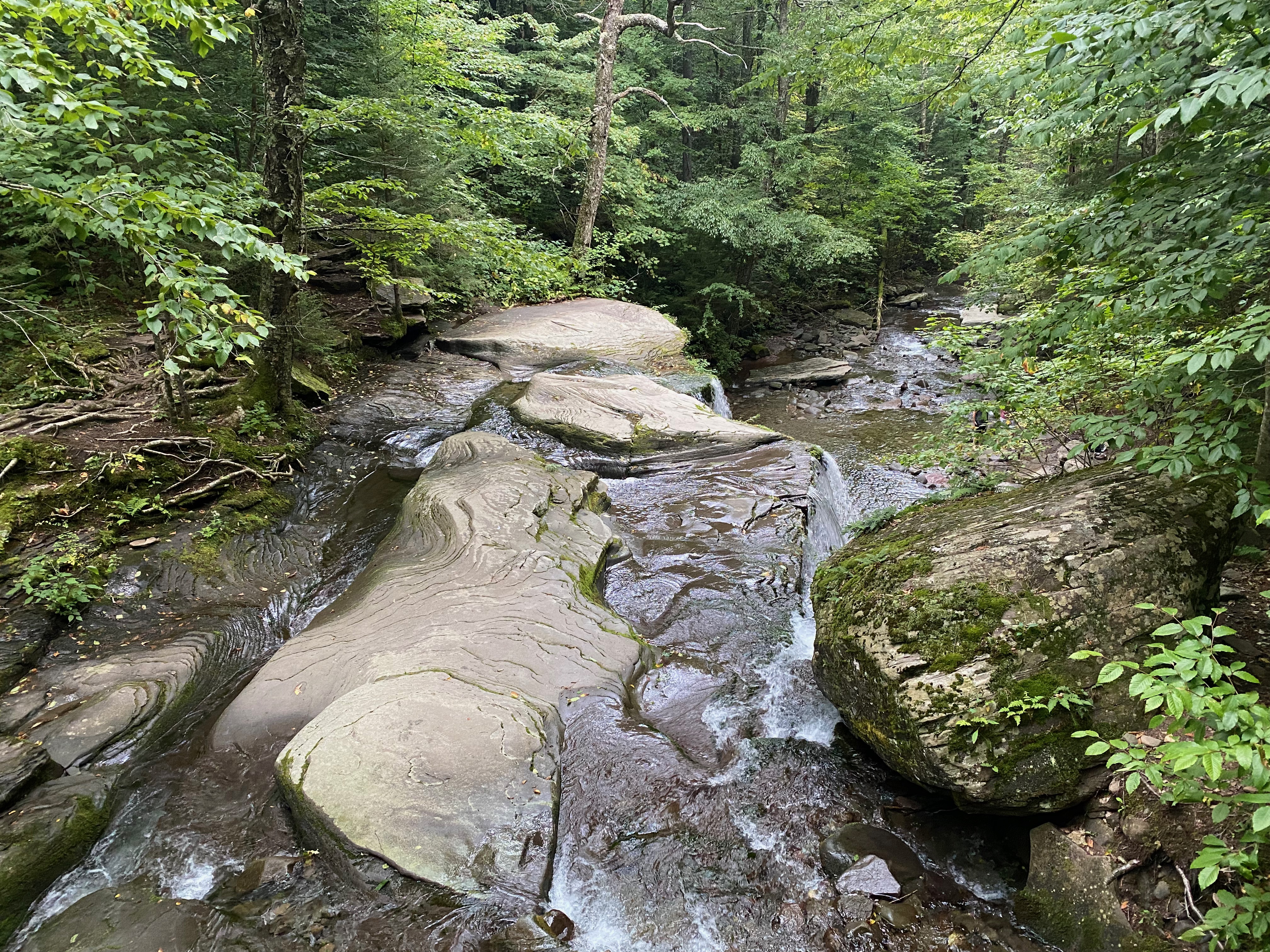
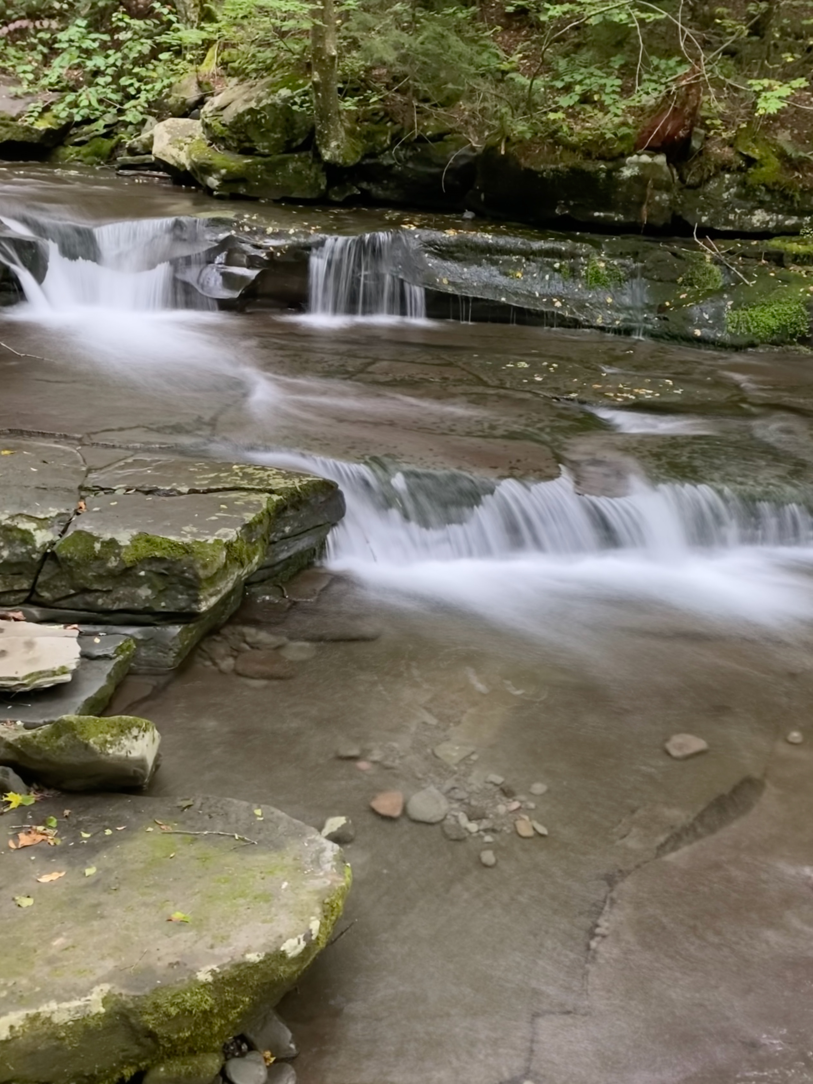
The Devil’s Path goes by the lean-to, ascends to the height of land between the two mountains, and then begins to descend fairly steeply towards Diamond Notch. The trail is rocky and washed out in many places, and footing isn’t always secure. This is a good place to take your time descending. After 2.2 miles, the Devil’s Path intersects with the Diamond Notch Trail right at Diamond Notch Falls.
From the trail junction, you follow the Diamond Notch Trail about 1 mile to the north, where it ends at Spruceton Road. The trail gently descends, following Spruceton Creek along the way and there are a number of beautiful cascades in the creek you go by.
Once at Spruceton Road, you walk about a half of a mile on Spruceton Road. You’ll pass the parking area for the Diamond Notch Trail on your left, and then you’ll come to the Spruceton Trailhead and parking area on your right.


Need Outdoor Hiking, Backpacking and Camping Guide Services to explore places like this? My husband and I own an outdoor guiding company and you can book a guided hiking trip with him at Hike On Guides.
You can find this hike:
- On the Trail Conference’s Catskill Trails Map Set
- On the National Geographic Trails Illustrated Map for the Catskills
Gear, nutrition, and hydration products I used on this hike:
- Osprey Talon 22 Pack
- Altra Lone Peak Shoes
- Black Diamond Trail Back Trekking Poles
- Darn Tough Socks
- Sawyer Squeeze Water Filter
- Energizer LED Headlamp
- NEMO Chipper Reclaimed Closed-Cell Foam Seat Pad
- The Complete Cookie
- Gatorade Endurance Carb Energy Chews
- GU Energy Roctane Ultra Endurance Energy Drink
- Jelly Belly Sport Beans – Energizing Jelly Beans

Thanks for the ringing endorsement and description of this loop. I’m planning a first overnight trip (other than car camping) with my son (13) and thinking this could be a good candidate, with the combo of moderate length plus an overnight at one of the lean-to/campsites.
Glad I could help!
tried it yesterday as a trail runner -drove 2 hours form NJ went up blue to peak but 1/4 mile into yellow I came to a boulder vista with ok view but no continuation of yellow signs from there, had no idea how to continue yellow so came back down blue, bummed. what did i do wrong?
Did you come from Spruceton or Becker Hollow on the blue? My guess from your description is you came up Becker Hollow to trail junction with yellow hunter mountain trail but went straight on short yellow trail that took you to old view instead of summit. You should have some good maps – a mountain like hunter has so many trails it’s easy to get turned around. This one is my favorite from the Trail Conference – https://amzn.to/45X4Sw2